Turn Right At Liverpool And Keep Walking- Day 180 – Cadora Woods To Hendre

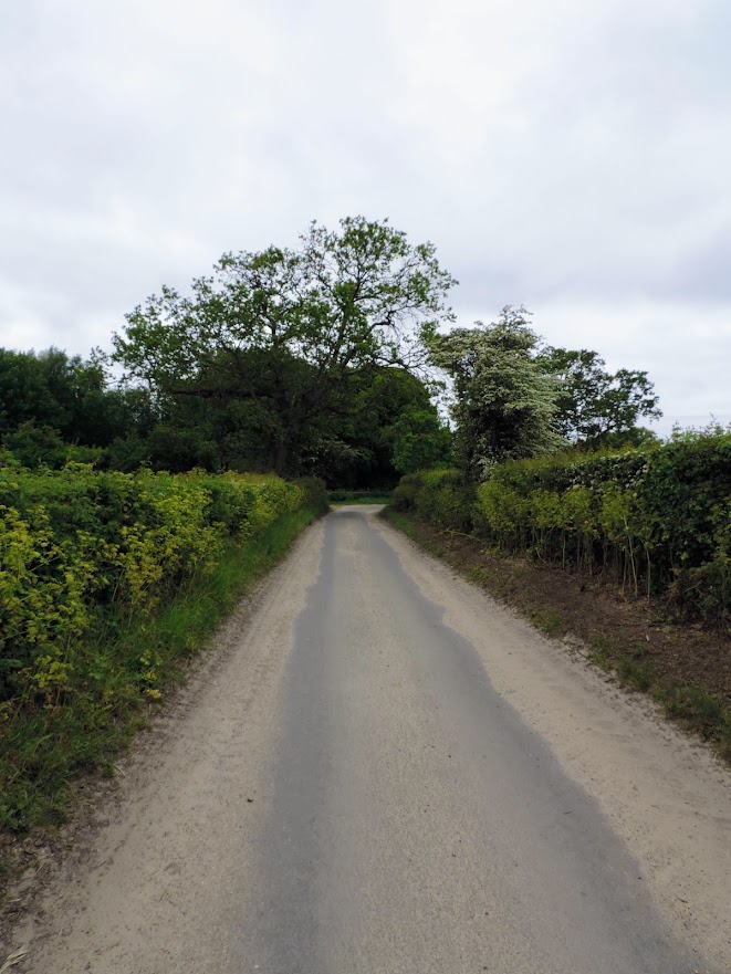
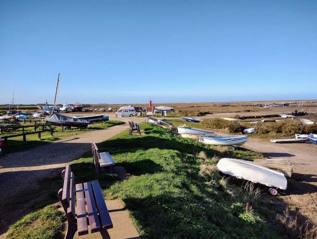
You get a good night’s sleep in a Weatherspoons. My only gripe was that the room was a tad warm. The other gripe was that it was pouring down. This was not a good start, but fortunately we were walking through some quite dense woodland. This at least meant that we were spared the worst of the showers. On the other hand it did put a downer on the day’s walk. I am at heart a fair weather walker. I want to see things and stay dry.

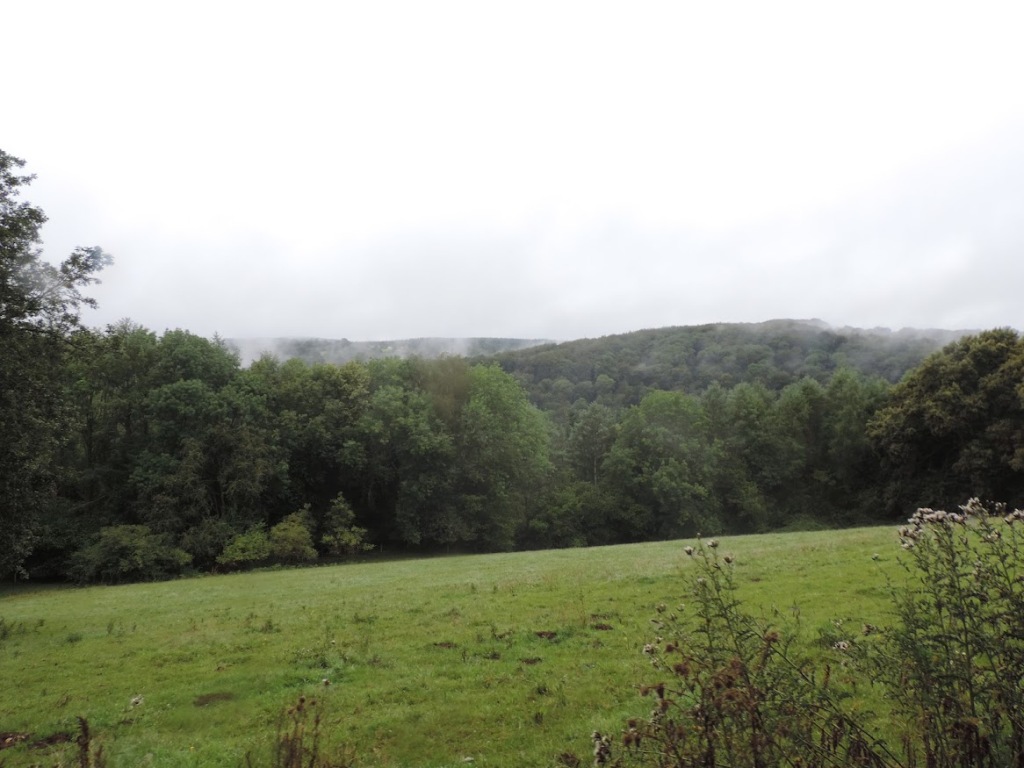
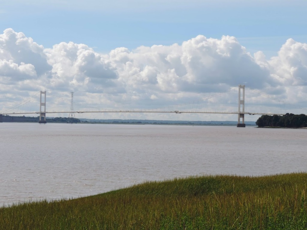
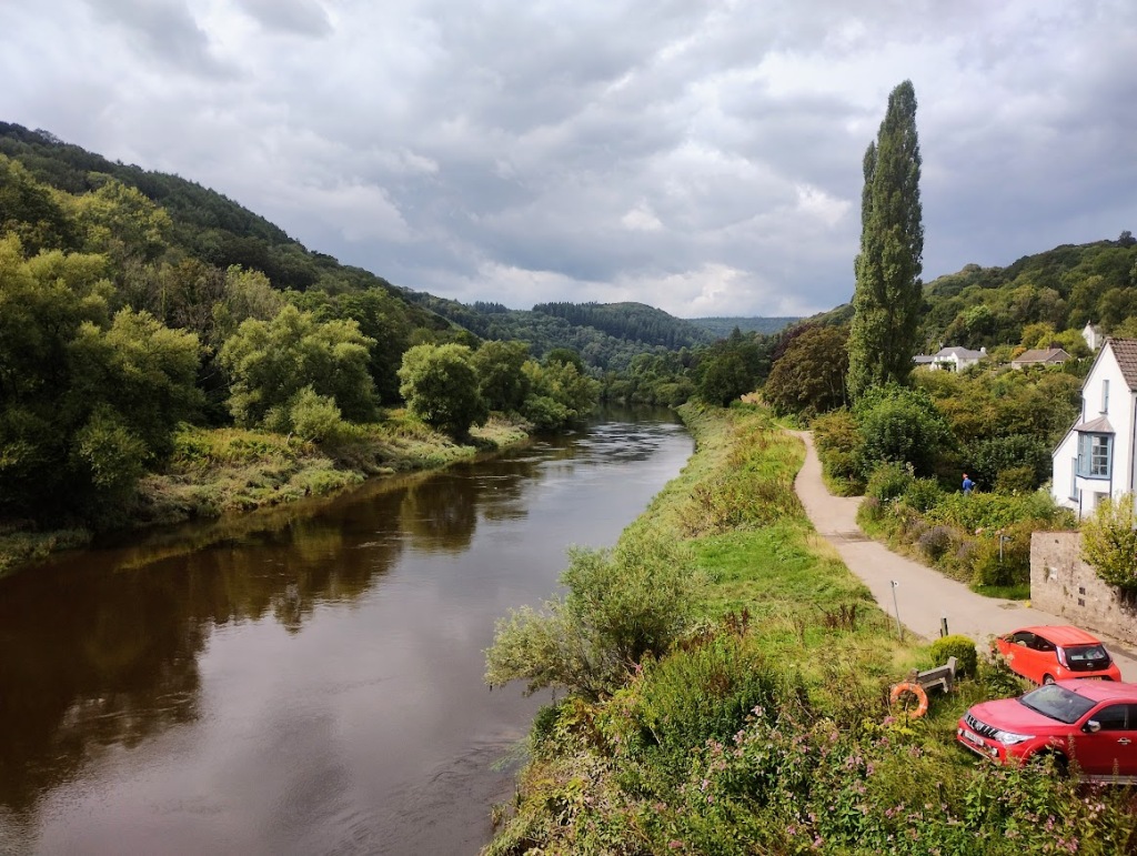
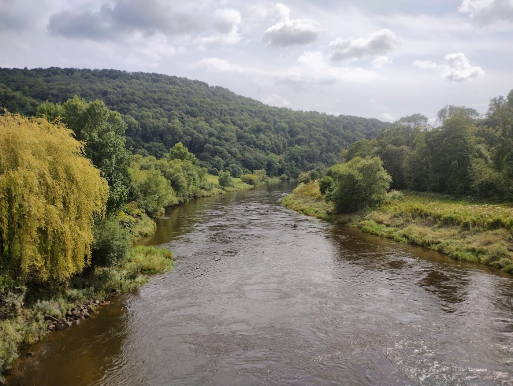
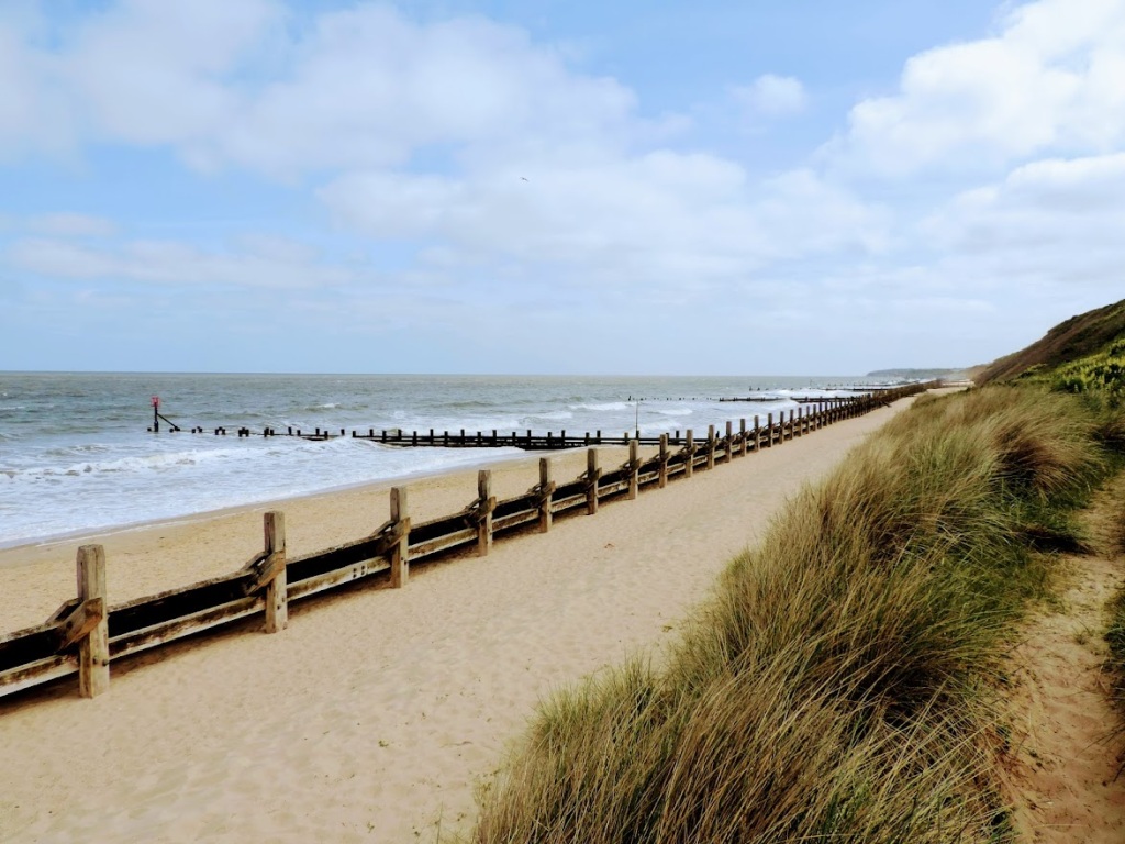
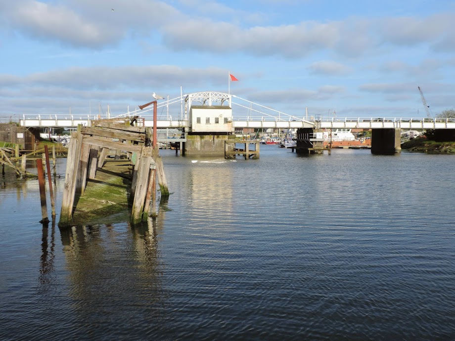
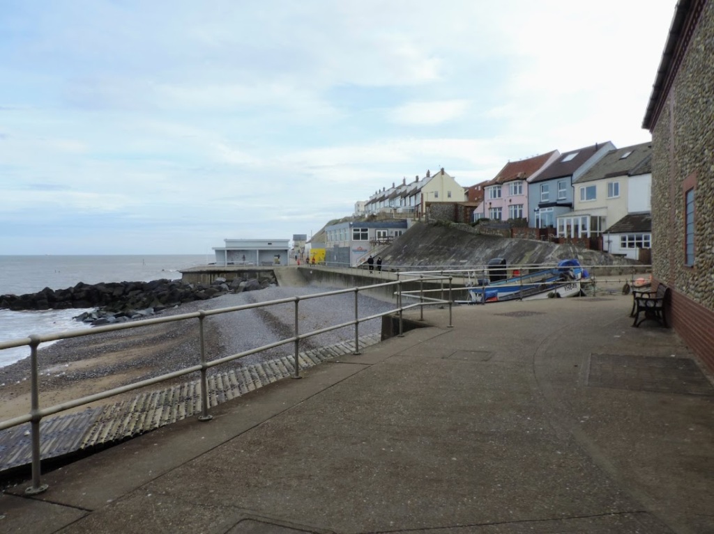
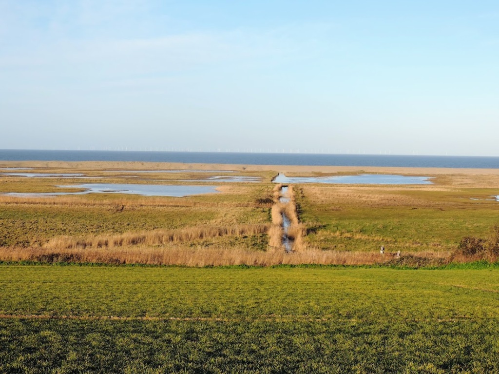
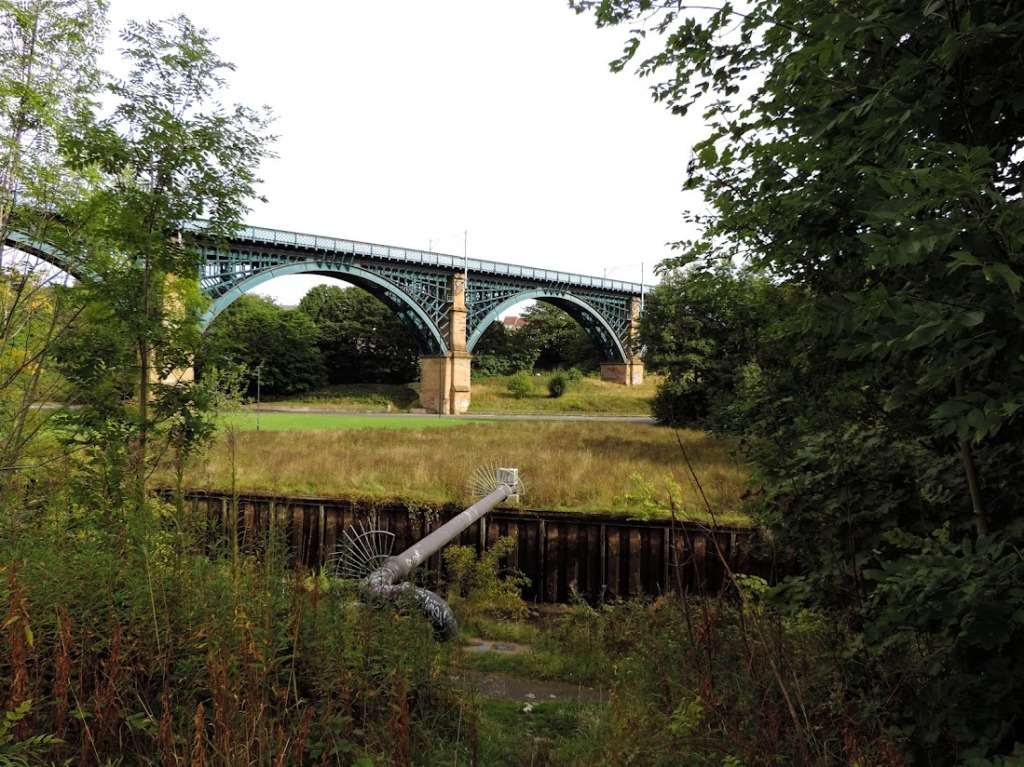
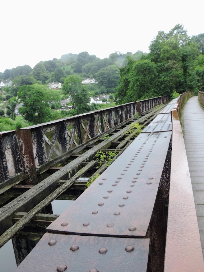
From Cadora to Redbrook it was mainly a steady climb through woodland, along woodland and through the occasional clearing so we could fully enjoy the traditional Welsh Weather. As we started our descent back into the valley the view down to the Wye and Penallt Viaduct at Redbrook briefly opened up to us.

The railway is no longer there. What were tracks are now just empty drops to the river. There is a footbridge alongside it which gives access to the Welsh side of the river and the Boat Inn. The Wye Valley Railway ran from Chepstow to Monmouth and opened in 1876 in the hope of opening up a route from Bristol to the Midlands. The dream was never achieved, but it did provide a boost for tourism and enabled quarry traffic. Redbrook had a station, but like all the stations along the line it closed to passenger service in January 1959, with a quarry service lasting to Tintern until 1981.

Our dream of coffee at the Boat Inn was also dashed, as it did not open until midday and we had arrived an hour before that. Still we had a snack of nuts and some water, whilst I took the opportunity to use the loos. I did later learn a useful fact, many of the churches along the route provide self serve tea or coffee for a donation. All you need to take are some sachets of milk.

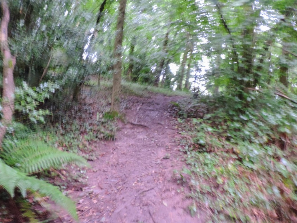
I am not sure if I was prepared for the route out of Redbrook. For nearly three miles it is a steady climb with a lot of false summits. It took over nearly an hour to reach the Kymin, our next stop. First a B Road, followed by a minor road, then a track, this changes to a path. They all have the same characteristic, the tendency to upness. It was a slog in the relentless humid drizzle.

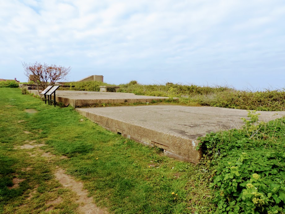
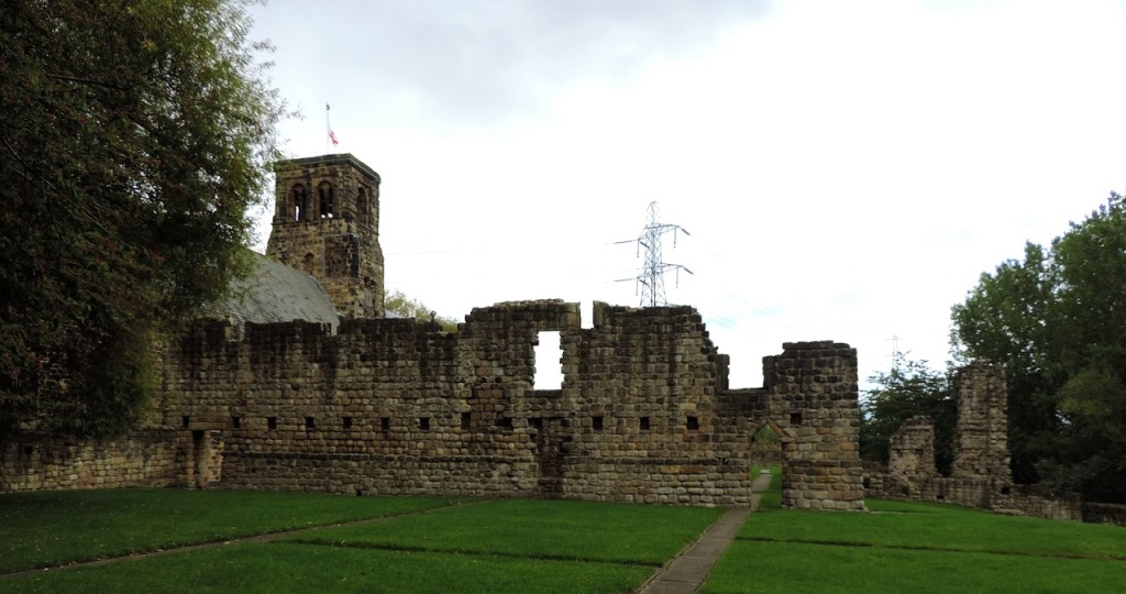
We were therefore extremely pleased to reach the Kymin. The Kymin is a hill which overlooks Monmouth in the valley below, it houses a Roundhouse and Naval Temple. It was built by Gentlemen from the Monmouth Picnic club who wished to have somewhere congenial to dine, away from the inclement weather (them too). The house was started in 1794 and completed two years later. A few years later they constructed a Naval Temple nearby to commemorate the Battle of the Nile. During Nelson and Lady Hamilton’s visit to Monmouth in 1802 (accompanied by her husband Sir William) Nelson visited the Roundhouse and breakfasted there. He was struck by the temple, and praised it as the only one of its kind in England.

The views over Monmouth were worth the climb, a steady roar of traffic in the valley below contrasted with the peace and quiet of the hilltop. We sat and ate our lunch taking in the vista.

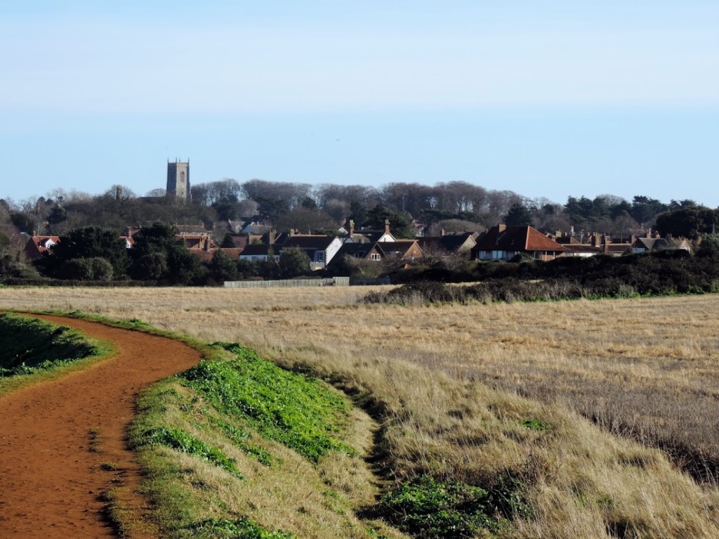
What goes up must come down, and so we started our descent to Monmouth. The first part through the woods was particularly slippy as the mixture of mud and leaves made our footing precarious. However, it was nice to be going down, something we managed in around half and hour and were soon entering Monmouth across the Wye.

I was very impressed with Monmouth as a town. I travelled by it last year whilst going to a wedding in Abergavenny. It is a typical Coaching Town, retaining many features.

The King’s head was reputedly visited by Charles I in 1645. The Inn was quite new then, but it has served as a hostelry for centuries. The Shire Hall, which is currently used by the Town Council dates back to 1724 and is at least the fourth building on the site, perhaps the earliest being an Elizabethan court from 1536. At the front there is a statue of Charles Rolls, of Royce fame, who all proper thinking Mancunians know did not meet his business partner at the Midland Hotel. Charles also was the first person to take the future King George V and Queen Mary in a car, when the visited Hendre in 1909. Charles has a sadder claim to fame than his Rolls Royce connection. He was the first Briton to be killed in an aeronautical accident in a powered aircraft when his Wright Flyer crashed during a flying display at Bournemouth in 1910.

Whilst I knew that Jake Thackray spent his last years in Monmouth, I didn’t think to look if there was any memorial to him. Had I done so I would have popped into the Savoy theatre and seen a bust of him in the foyer.

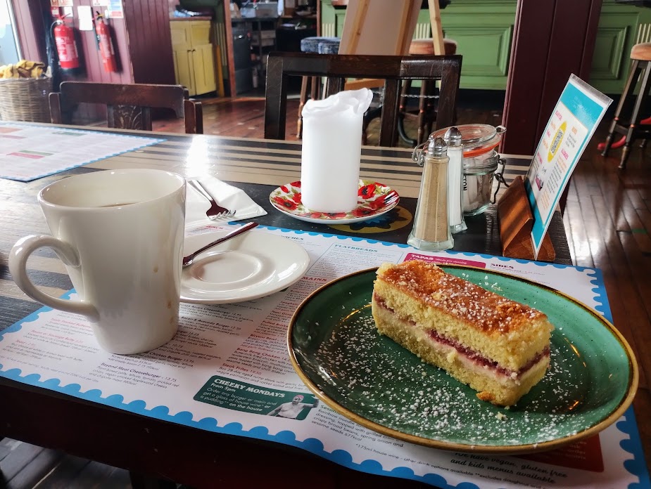
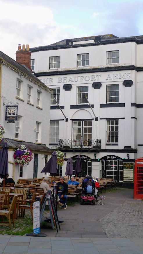
As we were making good time, we stopped at our now favourite cafe and partook of jam and cream cake and their excellent coffee once more.

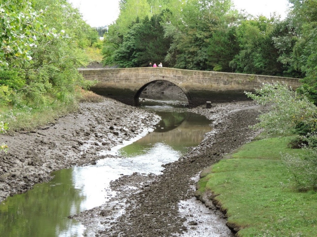
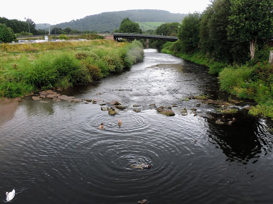
The rain wa not going to stop and we still had three miles to traipse, so it was across the bridge. The Monnow bridge is the only remaining medieval fortified river bridge in the UK. Construction began in 1272, to replace an earlier Norman crossing. The Monnow itself forms the England/ Wales border for much of its length.

Looking over into the river, we spotted some boys swimming. I suppose it passes for a heatwave in this part of the country.

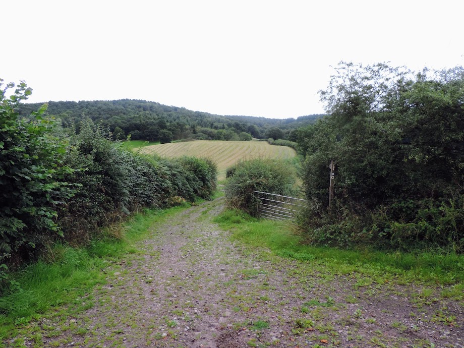
The final stretch of walk was thankfully flat but still through woodland, although not as dense.

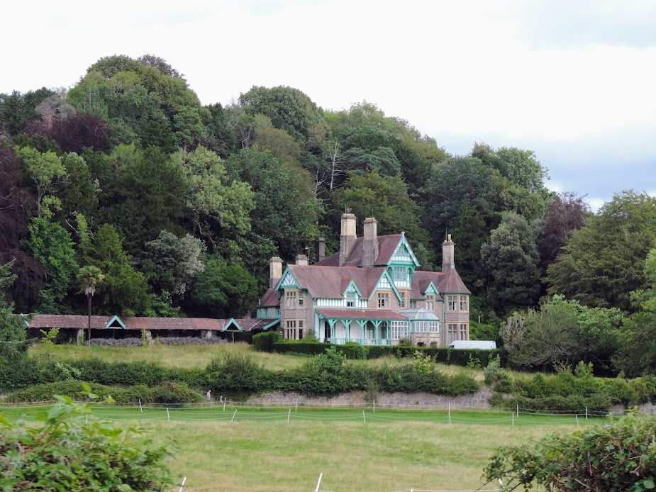
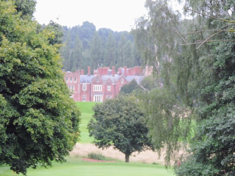
Just before we reached the car, I saw the Hendre to the right. This was designed as a shooting lodge for John Rolls in 1829. Today it houses a golf club.

Picking up the car, we drove to meet the ladies at The Hunter’s Moon pub. 13 miles covered today. 27 Offa and 1,809 in total. Map below video here:

© Allan Russell 2023.

Turn Right At Liverpool And Keep Walking- Day 179 – Sedbury Cliffs To Cadora Woods

Keith & I, of Hadrian fame, are starting Offa’s Dyke along the Welsh/English border today. Like the Wall, it was built as a border feature, and although not as solid as the Roman artefact to the North – it was an earthwork rather than a stone structure. It is twice as long as the Wall being 177 miles between Chepstow and Prestatyn,

We are also being joined for the journey by Keith’s wife Marion and her friend Caroline. They are walking one stage ahead of us, so transport to and from the walk is easier – we are dropped off, and pick the others up when we finish at what was their start point.

The Dyke itself is thought to have been commissioned by Offa, the King of Mercia between 757 and 796. Unlike the Wall, there is much less evidence of its existence, parts having been lost as late as 1928. More recent investigations have dated some parts of the wall to between 430 and 652 and some to as late as 1019.

We are setting off today from Sedbury Cliffs on the Severn near Chepstow. The ladies completed their first stage in April. This gives a spoiler alert, as they did their walk in the early spring. They had better views – the trees were bare and the views better. However, the girls are coy about the route which means I did not rely on Komoot for stage one even though I had planned a path from an Offa GPS. That gave us a couple of small problems but the route was in the main well signposted.

There’s also been a lot of rain, but the weather is good today, and surprisingly there is little mud around. I stayed over last night at Keith’s and we set off at a sensible time to start from the River Severn near the Prince of Wales Bridge which was originally built in 1966.

And of course a selfie to start the route.

Sedbury cliffs are known for fossils. There isn’t much cliff to see at our start, it is covered by trees. Still the first half mile or so is through nice easy country, although it is UP. I do realise being a coastal walker the default is flat but we are walking a border up a river into the Welsh mountains. The corn is as high as an elephants eye en route and we soon come into the outskirts of Chepstow which we relatively quickly circle to get back into the countryside after navigating through some estates.

Over the Wye on the other side of the valley Chepstow Castle (built 1067) is just visible through the foilage, and we pass Folly Mill in Tidenham, a cornmill built in 1754.

A little further on we walk near Pen Moel which was built in 1842. This was built for the Philips family of Manchester, I have written about these on my Halls blog. Robert Philips daughters, Isabella (1807-1889) and Anna Priscilla (1804-1879) came to live here. After they died it was inherited by their niece, Margaret Philips Price, who demolished it and rebuilt it in the current Arts and Crafts style. She lived their with her husband, but had visitors including Arthur Hyde, whose family owned Quarry Bank Mill.

It’s a lovely house, but if you are thinking of buying it, it went for £1.5m in 2016.

After this it was a case of walking up through the forest alongside the river. As I said we were deprived of great views, and had to spend a lot of our time looking down to avoid tripping on the tree roots below. We then fell foul of a misdirection. Someone had switched the direction of the sign as we walked onto the B4228. To be honest it did not feel right to be walking in the direction we did, and after half a mile a look at the compass confirmed we were heading south, so we turned back and rejoined the route.

We did get a good view of the Wye at Wintours Leap, where Sir John Wintour escaped the Roundheads by descending the cliffs. It was not as treacherous then. We did meet someone who intended to climb down the rocks, but we thought better of it.

At this point we are walking on a hill between two rivers, and could see the Severn in the distance at times. The Wye flows into the Severn, but they start only two miles apart.

Soon after that we actually walked along the Dyke, The workings are still visible, if obscured, but you can make out that there is a structure here.

The path was easy here as we walked under the canopy of trees, but as I said earlier views are at a premium.

However, after a long climb we came to the Devil’s pulpit and were treated to magnificent views of Tintern Abbey in the valley below. It’s a shame as this was a perfect spot to eat lunch, but we had given up and dined in a small hey earlier on, sitting on some logs.

I visited Tintern in 1976 when I took a motorbike holiday around South Wales and was enraptured by it even then, having seen Turner’s painting around the same time. It was founded in 1131 and work on the current structure began in 1269. However in 1536 it fell victim to Henry VIII and entered a slow decline.

It is a popular spot to sit and take pictures, and this was evidenced over the next mile or so when we passed a lot of people climbing the hill. Most of them asking how much further. I do wonder how many managed it to the top.

After the long descent we reached Brockweir on the Wye. This was the highest point that seagoing vessels were able to reach on the river, after that cargo had to be carried on shallow barges, which were manually hauled upriver. We had hoped for a coffee or ice cream here, but were disappointed. So instead we took in the peaceful view whilst sat on a bench.

Only three miles were infront of us now, and it was very easy going along the riverbank, passing the pretty village of Llandogo nestled in the valley on the other side and Bigsweir House, a mid 18th Century Grade II listed building.

An easy walk from Bigsweir House got us to the bridge. Reaching Bigweir we found the car at Cadora Woods carpark.

We then drove to Monmouth, where we had what is possibly the best cup of coffee I have ever had at Estero Lounge. Plus some excellent Jam and Cream Cake. What’s not to like. We stayed the night at the King’s Head, a Weatherspoons in Monmouth (excellent value, my second stay in a WS. The evening we dined at the Lion Inn a few miles out. Marion, Keith’s wife, has developed a love of open mike nights after an enjoyable evening in Tynemouth at the end of the Hadrian Walk.

So, 14 miles covered. First stage of Offa. There is a slight cheat here. This may count towards my coastal walk, if I dont make it this far. It can be a circuit of Albion. I think there is mileage in that. Talking of mileage (segue) 1,796 in total now. Map below. Video here.

© Allan Russell 2023.

Turn Right At Liverpool And Keep Walking- Day 178 – Lowestoft To Wrentham – 30 May 2023

I always have a good night’s sleep after a long walk, and generally wake up early. 04:30 this morning, which is good timing to catch the first train into Lowestoft, there being no breakfast served at the hotel. My plan is for a McDonald’s.

Arriving in Lowestoft I start out to cross the river, and am held up by the bridge, which rises to let a large ship through. As it is a novelty I am one of the few people in the queue who is not inconvenienced.

The town is empty, this being very early. The sea is also much calmer on this side, with a sandy beach stretching in the distance. The south side seems to be the tourist side, I find the only breakfast place open, which is McD, but have the worst meal ever and have to leave it. Stale bread, and everything tastes like it is cooked in dirty fat. On the good side it has put me off the place for a very long time. Probably put me off eggs too.

This does appear to be the more genteel side of town, with a terrace of Victorian houses some of which I guess were once hotels, or perhaps merchant dwellings.

The town becomes more pleasant as I leave the centre, and with the beach huts becomes more of a seaside place than port.

However, the suburb of Pakefield has suffered from a great deal of coastal erosion. On reaching here, the path (which is still not signposted as coastal) veers off into the town, and there is a diversion along the main road. It is depressing walking with cars whizzing past constantly and the only interest along this route is the advert for a Rock’n’Roll revival weekend later in the year. Charlie Gracie is topping the bill, as he did in 1957 at the London Palladium. I wouldn’t rush to buy a ticket to see him on this show though, as he died in December, aged 86.

After a walk through fields and some housing estates in Kessingland, I reach the beach once more. Kessingland has its fame through its Jurassic and Neolithic treasures which are found in the crumbling cliffs from time to time. The beach path is firm and grassy which makes it an easy walk. However it is barren and given that the day is overcast, very bleak. Having been to parts of Suffolk before, I remember the coast is a lot like this (Southwold excluded) and remember that I have Sizewell to negotiate further south. The area is quite sparse and barren.

I see on my map there is a waterway to cross. I never quite trust a crossing until I am on the opposite side. However, this one is real and once more I am diverted inland as a sign (just telling me the beach is blocked by erosion, not indicating which is the coastal path) tells me so. I bid farewell to the bleak coastline and wander to my destination.

It is country lanes and farmtracks now. At least the road is quiet and the only obstacle I have is an irrigation hose which is spraying more water onto the tarmac than the surrounding fields. It’s a three mile hike into Wrentham and the time passes quickly.

Arriving in Wrentham, I spot more yarn bombing,

and catch a bus to Norfolk (handy for the return journey I think) The one drawback with that plan is that the bus station in Norfolk is 2½ miles from the train station. You also have to wander into the centre to get a bus to the station. Why did they build the train station so far from the town centre? So it would be near the railway line!

Anyway, rant over, 10 miles covered today. 1,034 coastal and 1,782 total. Two bad meals in Lowestoft. Lesson is don’t eat there.

Map below, video here.

© Allan Russell 2023.

Turn Right At Liverpool And Keep Walking- Day 177 – Great Yarmouth To Lowestoft – 29 May 2023

Another early train to Norfolk. This time it is the direct route. The train strikes this week mean I can only afford one overnight for fear of being stranded in deepest East Anglia. Arriving in Great Yarmouth I make my way along the river Yare and cross it at the last bridge. I can’t say that the other side of the river is more scenic, being that it passes through docklands. As you can see the seaside town exists cheek by jowl with the dockside.

A little further along, another bridge, Herring Bridge, is being constructed, to open later this year apparently. The river obviously has active traffic as this cost £120m and was brought in by sea from Belgium.

Passing Koolunga House (built 1826) which is now lats but once was a private residence with extensive gardens, I passed through more dockland until I reached the mouth of the Yare and after nearly 2½ miles of walking reach the beach at Gorleston on Sea.

Gorelston is as old as Yarmouth, and once the Yare formed the border between Norfolk and Suffolk. Like its sister on the opposite bank it grew to prominence with its Herring industry but as that declined became a seaside resort. It is much less brash than its neighbour, but boasts a fine sandy beach. The Danny Boyle film Yesterday used the beach as a film location. I can’t admit to being enamoured with the town side, but as I walked along the cliff path above the beach I could see its charms.

By now I was quite hungry and having wisely eschewed the chip shop by the main town (the fish looked horribly burnt – unforgiveable for a fishing town) I chanced upon a stall selling freshly made panini, and treated myself to a caprese salad, whilst shivering in the summer sun – today was not warm on the East Coast (in contrast to home).

The next stage took me along the beach. The sand was soft which made the going hard, and I also did not quite trust the map which said there was an exit at the other end. The sea defences looked endless and I could not see any gap in the cliffs.

Still the Norfolk path was signposted down here, so I ploughed forwards, even though I was the only person around.

The waves were quite rough against the sea defences.

As I got towards the end I could see more rip rap and the sea was closing in. However, I did spot people on the other side, which meant that there must be a way out (if not perhaps through). Komoot was not lying and I could make my way up a path to the cliff top at Hopton. The Beach from hereonin was not passable.

Entering Suffolk (no fanfare, it was not even signposted – perhaps the only indication was the loss of the useful Norfolk Coast Path signs, something the Suffolk tourist board seem unwilling to invest in, I only saw one in my two days of walks.) I passed a bright display of Red Hot Poker flowers near Corton.

As well as some postbox yarnbombing.

Nearing Lowestoft it was once more time to descend to beach level through a canopy of trees. The beach now became quite scrubby.

Finally I reached the outskirts of Lowestoft. The sea was much rougher here, and it was a relatively calm day. Your can see how it is encroaching on the town, as the old promenade wall has been long conquered by the waves.

The power of the waves is quite awesome here, they were crashing over the promenade, I shudder to think what they are like if the sea is angry. Even Turner depicted their force.

Lowestoft boasts the most Easterly part of the UK, at Ness Point 1º 45′ 53″ East. Naturally this was time for a selfie, and bowing to prior criticisms of my performance at Great Yarmouth, I smiled.

I then turned inland to find my accommodation for the night, and realised that I had misread Booking.com and chosen a lodging 2½ miles from the centre. I started to walk, but spotted that it was on the train line out so jumped on the Norwich train to Oulton North where I had an awful curry at the station restaurant before finding the Wolf Inn.

It turns out the choice was good, £40 per night for a very comfortable and quiet ensuite, and by Oulton Broads which gave me the opportunity for some pictures before I retired.

12 miles today, 1,024 coastal to date and 1,772 in total. Map below, video here.

© Allan Russell 2023

Turn Right At Liverpool And Keep Walking- Day 176 – Scratby To Great Yarmouth – 01 May 2023

Up early this morning and across the road for a McDonalds Breakfast, and a taxi back to Scratby. Have a great conversation with the driver who is going to move up to the North East, Whitley Bay, I envy him, he isn’t keen, prefers Norfolk. De Gustibus. My first passing point is California, it isn’t very Californian. I can’t even find out why it got the name. I suppose the beach could pass though….

Despite being nearer to Great Yarmouth, it still is not very built up around here. Just more sand dunes, and an isolated pill box. Despite a threat of rain, the going is good and I make good time.

I am soon in Great Yarmouth, and really there is not much at this end, a bus depot which has a bus going to Bernard Matthews. He’s big in Norfolk. The river Yare, which separates the town from Little Yarmouth on the other side, and the station. There used to be three in town in the holiday heyday, Now there is just a two track platform.

The beachfront was nice, so here are some pictures I took the previous day.

Anyway it was only a quick walk to get me to a decent place for my next stage, 6 miles, 1,760 in total and 1,012 on the coast, and I was at the station at 08:48 in very good time to catch the 09:17 train back to Norfolk and thence home.

Map below, video here

© Allan Russell 2023.

Turn Right At Liverpool And Keep Walking- Day 175 – Bacton To Scratby – 30 April 2023

After a very good night’s sleep, and a hearty breakfast I set out once more on my trek. Forgetting my walking pole – a fact I only realised after 3 miles walk when I needed it. The beach at Bacton had a few dog walkers, but generally there were not a lot of people around.

I was then faced with the beach or cliffs dilemma once again. This time I opted for the sandy road, even though there was clearly a long way to the next exit, and the sea defences placed a border between me and the land side of the sands if I wanted the option of the harder sand. It turns out I made the right choice, although only just.

There was a lot of evidence of erosion on the cliff side, where erstwhile caravan sites had dropped into the sea.

There were also some strange structures, which I did not understand. Still they made for good pictures.

It was at this point that I realised I needed my walking pole. At Happisburgh The beach was protected by riprap and this time there was no real path around it, as the tide had left deep pools on the cliff side, so I had to gingerly climb over the slippy rocks to continue.

This allowed me to reach the beach at Sea Palling, which was by this time fairly buzzing with holidaymakers. There had been a sea swim event as many people were huddled changing on the beach trying to warm up, Of course some people had just sat in there warmest clothes possible whilst taking in the sea air. The sauna looked the best bet to me today, although sunny, it was not warm, and certainly very windy.

Sea Palling was a good point to stop and I had an excellent cup of tea on the cafe to the left of the picture. She let it brew for a good few minutes before adding the milk. The village suffered badly in the Great North Sea Flood of 1953 as you can see from the picture in the cafe.

It was then back inland to continue the walk. I had been looking forward to seeing the seals during this stretch of the walk and as soon as there was an opportunity to rejoin the beach through the dunes I took the chance, and I was not disappointed. It was moulting season and a notice said that 1,420 seals were on the beach. I particularly liked on little chap who had decided to surf and was coming in with the waves.

After that it was back on the path to Winterton on Sea. It was around 6 or seven miles walk between Happisburgh and Winterton so I was glad to sea the village appear in the distance. Winteron was going to be my destination for this walk, but I had made good time, and was not tired. So I stopped at a chippy for a fish and mushy peas and then set out to see how much further I could get.

Although only about 8 miles from Great Yarmouth, I was surprised how rural it still was. I had expected Winterton to be a largish place, but it was only a small village. Much of this I guess is due to the coastal erosion. As I walked towards Hemsby, I could see houses far inland, but they kept a sensible distance from the waves. Hemsby itself is built closer to the coast and it has suffered in recent months from an acceleration in erosion. Some houses have fallen into the sea, and many were up for sale. Given the publicity and sensible searches by lawyers, I would guess it is a hard sell. It must be awful to see your house collapse over the side of a cliff. At one point, the coastal path was blocked by such a landslip and I had to detour. Still, there is always English pluck.

I eventually arrived at Scratby, where I decided to call it a day. I was not over tired, but it was a further six miles to Great Yarmouth, and my route took me away from any buses, so a bus stop and the last bus for two hours being due, I stopped.

At Great Yarmouth I had opted to stay at the Wetherspoons, mainly on a recommendation from one of my favourite You Tube Channels, Walk With Me TIm.

After the initial shock of walking into a heaving bank holiday crown, I was very impressed with the room. It was clean, spacious and quiet.

After a cup of tea, I went to explore the town, but first I had a task. Aged 8 or 9, we took the Summer Special one Saturday for a holiday in Great Yarmouth from Manchester Central Station. I remember it was a steam train and at one point we hit the dizzying speed of 100mph. I discovered a slide of my mum, sister and me on holiday and I decided to revisit it. Excuse the frown, I have already been told off for not smiling.

17 miles covered today, giving a total of 1,754 to date and smashing the 1,000 around the coast at 1,006. Map below video here. I almost made it to California!

© Allan Russell 2023

Turn Right At Liverpool And Keep Walking- Day 174 – Cromer To Bacton – 29 April 2023

Determined to carry on despite rail strikes and a stagnant housing market I catch the 05:14 to Nuneaton to start my trek to Cromer. It’s late, as is the connection at Nuneaton, as is the connection at Peterborough. Still the connections are slack enough to ensure I catch all trains with ease, if not some frustration. Thankfully the Norfolk – Cromer train gets me to my destination on time, and I walk into a busy seaside Saturday in Cromer.

Norfolk has the sunshine that has been missing in the North West all year and the crowds are enjoying the warmth. The tacky shops are selling the traditional seaside tacky goods and all is well with the world.

The Hotel De Paris, overlooking the Pier has a long history. It was the first proper hotel in Cromer built to accomodate the growing holiday traffic, which was growing rapidly, even before the railways came along. In 1830 Pierre De Francoise, an aristocrat fleeing the French revolutions came to Cromer and purchased a large house on the site which had been built in 1820. Initially it was advertised as a boarding house, but by 1845 it had prospered enough to style itself the Hotel De Paris. Growing competition in the town from other new hotels, inspired the new owners to construct the Grade II building we see now in 1891.

Setting off along the prom, I passed the lifeboat station and climbed up to the cliffs passing the lighthouse, affording me a farewell vista of the pier.

The path now ran alongside the coast and afforded specatular views over the beach and surrounding countryside. Early spring gave everything a wonderful splash of colour. Oh to be in England now that April is there!

What goes up must come down, and I walked along the beach past Overstrand (which styled itself the “Village of Millionaires” in late Victorian times) and towards Sidestrand, where the path became confusing. My Komoot said continue (there was a steep hill and I did not relish a climb) but the path did not appear to lead anywhere.

I opted to ascend the steep hill, but half way up, spotted a path going around the coastal defences, and people following it. I therefore took a short cut down the slope and made my way over the boulders onto a very pebbly beach. There has been significant coastal erosion here and much of the cliff collapsed, leading to the installation of groynes and imported rip rap (basically very big boulders from Norway at £1,300 per shot). The cliffs are high and whilst there were some people surfing in the waves, it was very isolated. So much so that I lost my phone signal and picked up a maritime network. Here is a google earth of the works.

I walked for a few hundred metres, but looking ahead the pebbles looked far too hard to walk over for any great distance, plus in the distance the tide looked like it had come right in, blocking any potential exit. I therefore turned back, and made my way up the steep hill, to stop at the top, take on some water and eat my bananas. They had turned to mush in the heat so it was more a case of sucking them with a straw.

However once starting off again the path was pleasant easy walking (if a mite too narrow in places) and I started making good time again.

My next calling point was the pretty village of Trimingham. The church, known as St John The Baptist’s Head once had a lifesize alabaster model of said Saint’s cranium. Pilgrims used to come here instead of Amiens where the supposed real bonce is kept. However the relic is thought to have been destroyed as part of the injunction against graven images during the time of Henry VIII or Edward VI. The village hall still maintains the links with pilgrimages, and is known as the Pilgrim Centre.

Back to the clifftop path, there were some scary drops to the sea.

At Mundesley there is a WWII coastal battery which was once manned by the Mundesley, Gimmingham and Trunch Home Guard. Despite the fictional Walmington on Sea being located in Kent, it was filmed in Norfolk, and there are Dad’s Army attractions in the County. Some would say Norfolk is still in the 1940s. I think it is all the more charming for its olde worlde England atmosphere.

Thankfully the beach was back to golden sand , which made it more pleasant to walk along for a short stretch. However once more cliffs beckoned (this time it was the wrong decision, I should have continued along the beach). After a mile or so I came up against the Bacton Gas terminal, and the path stopped abruptly. I had to detour along back across the fields to the main road,

However, every cloud, and it gave me the opportunity to see the Church of St Margaret, Paston, built in the early 1300s on the site of an earlier church on the pilgrims route (to St John The Baptist). The Paston family grew from poverty to great wealth during the Black Death by building up substantial landholdings in the area. Clement Paston bought up the land, his son, William (b 1378) studied law and rose to become a judge, marrying well. William’s son John also studied law, and befriended a local knight, Sir John Fastolff (Shakespeare’s Falstaff) and gained his confidence to such and extent that he was bequeathed all his property in his will. This mightily irked Fastolff’s relatives and gave rise to much legal wrangling over the next years until the superior legal skills of the Pastons defeated the nobility for once and all.

After the unplanned but ultimately pleasant detour, I arrived in Bacton. I still had some distance to cover, as my accommodation was on the opposite side of the village some 1½ miles to cover. Bacton has a fine beach and my B&B was quite frankly the nicest I have ever stayed in, and I heartily recommend it. The Seals Bacton had nice clean rooms, a friendly welcome, a fantastic beach side location, brilliant breakfast and an excellent pub next door. What more can a boy want?

After a good meal at the Poachers Pocket next door, I retired to my room, and crashed (I had been awake since 03:15.

14 miles covered today, 989 along the coast so far, and 1,737 in total. Map below, video here.

© 2023 Allan Russell

Turn Right At Liverpool And Keep Walking- Day 173 – Salthouse To Cromer – 09 February 2023

After a good night’s rest, I am refreshed. It looks a bit more chilly today and waiting for the bus certainly feels it, however it is a much shorter ride to get to my start point.

I am hoping to do the whole stretch to Cromer, but am glad I can abandon if I want at Sheringham. That depends on detours. However, setting off at 09:30 there should not be much problem.

There is a long track to the coast, but I am gladdened by the fact that today I will be mainly on the coastline. Which is why I am a little dismayed when I spot the nature of the coast here. Very pebbly. I do not relish trekking the whole distance on these pebbles, and soon realise the value of Komoot when it tells me that my path is 80 yards to my right.

I have to at least see the sea, so I do make the first part of the journey on these stones. The landscape is bleak here and the few people on the beach are fishermen kitted up to keep them warm and dry whilst they attempt to catch something.

Fortunately the good folk who designed the path have kept these stretches to a minimum and there is a track of sorts between the pebbles and fields which make the going easier. The first point of interest is an army training camp. Howitzers pointing seaward. There is also a lot of RAF activity around this area, and on both days I have seen fighter jets training overhead. Today it was a helicopter first though. The MOD site is near Muckleburgh military collection . I guess the two are connected.

Soon the path climbs to cliffs above the beach, which does give the opportunity of views around the area and I start making good time, On the beach are remnants of WWII defences.

I am glad to be on the path but I do spot that it is a little more undulating than I have been used to since I left Yorkshire.

As I am relatively near a big town, there are more people ahout who presumably have driven out to walk the dog, take pictures or just take in the views, and to be honest it does have its own charm.

Infact very soon I am almost near Sheringham, where I walk alongside the golf course and see ahead that Norfolk is not quite as flat as it claims. The hill ahead is not high but it is steep and puts me in mind of the switchback section of Hadrian’s Wall, though it is not quite as cruel as the North Yorkshire cliffs.

Fortunately at the top there is a bench outside the coastguard station where I can rest and take in the views. There is also the reward of Sheringam on the otherside, sitting compactly between the hills.

I have made good time and know now that I will make it in time to catch a train back home.

Descending rapidly into Sheringham, I am disappointed. The sea defences on the promenade do not make for a seaside feel. More of a concrete monster, like Penmaenmawr. Even the huts don’t look inviting. I may be unfair here, it is low season February.

There is a little attempt to get a Beatles ambience, but I don’t quite think it works. The nearest the Fab Four came to here is Great Yarmouth or Norwich.

It’s another climb out of town, first up some steps, then a long concrete ramp followed by what the locals call the Beeston Bump, a 230 foot high hill. Here I get my first views of Cromer.

The beaches become sandier here and this part is more attractive to holidaymakers as can be seen with the numerous caravan parks I pass. I discover that West Runton’s claim to fame is that a fossilised Mammoth was found here. There is a statue commemorating it.

I see the hotel to my right and soon am approaching my end point. Here the path goes to the main road, and it is a dull walk through East Runton (I wonder if there was a wall) and the path makes a pointless detour down an alleyway when it could have just stayed on the road. However, Cromer appears. Followed by a sign which makes me smile.

My first visit to Cromer was with my kids, we stayed at the Cliftonville Hotel (which I had considered for my walk, but it did not do breakfast). However I am glad to see the pier and sands. I enjoyed my week here.

I have made really good time. My original ETA was around 13:45 which would have given me time for fish and chips. However, I realise I can make the 13:52 train if I rush, so I go to the station satisfied with the two days walk.

10 miles today, 1723 in total and 975 on the coast. Map below, video here:

© Allan Russell 2023.

Turn Right At Liverpool And Keep Walking- Day 172 – Wells Next The Sea To Salthouse – 08 February 2023

Another gap, winter, house move (failed) train strikes. The list is endless and I must admit the lack of walking has made me nervous about starting up again. It is not made more attractive by making a trip to distant Norfolk in mid winter. However, I steel myself and set off on the very long train journey to West Runton. Leaving home at 09:30 I arrive at my destination around 17:00. I catch a ten minute glimpse of Norwich in between trains.

The hotel (Dormy House) is well situated, and comfortable. I can even see the sea from my window, and its a shortish walk to the cliff edge, should I want to. I don’t this evening, and have an indifferent burger in the restaurant and retire early to bed.

Kippers for breakfast cheer me up, plenty of tea to drink and I walk to the bus stop to catch the Coasthopper service to Wells. It turns up on time and it is a 50 minute journey down extremely narrow roads. How the driver manages to negotiate them is amazing.

I recognise the town from my stay with Julia a few years back. It is as pretty as it was then, and much less busy off season. Setting off down the main street I retrace my steps to where I left of (back in May!!) and start walking along the quayside.

The coast path is well signposted and I don’t really need Komoot to show me the way, though it is handy for little mid course corrections, and a warning that you have strayed from the route. Passing lobster pots I enter the Broads proper. Although cold, there is no wind and the sun is warm enough to make the going comfortable. The ground is mainly dry and apart from some muddy slippy patches early on, easy to walk on.

There are a few people out walking, or jogging with their dogs and everyone I pass greets me in a friendly manner. I do like Norfolk, not quite as much as I do Northumberland, but nearly so. It is a haven for birdlife here and there are a lot of hides en route and sanctuaries. The avian folk mainly enjoy themselves in the warm winter sun.

The Coward quote, “Very Flat Norfolk” keeps coming to mind as I wander along the path. The views are beautiful over the peaceful green landscape interspersed with water channels and some bushes. It is good to be on the walk again and it is extremely peaceful.

Occasionally there is a boat, seemingly abandoned in the tundra. or perhaps that’s where the wild ones grow who knows. Chandler farmers may harvest them from time to time.

After six miles I reach Morston Quay, a NT reserve where I stop to take in the view and have a rest and drink. Unfortunately the cafe is not open until the 11th (there are plenty of visitors so it seems a shame). You can take boat trips to see seals from here.

I mentioned earlier that the path is well signposted. You can see in below how they even indicate when you can leave to catch a connecting bus. I also noticed that they keep the signage when you are being directed down narrow alleys away from the coast. This was a great change from Lincolnshire where it was generally a case of busking where you thought the route should go. Hopefully that will change soon as the path should be finished this year.

The nicest surprise en route was the village of Blakeney. It was once a thriving medieval seaport and haven for pirates who raided Flanders. It also had a packet ship service to London and Hull. Nowadays it is peaceful, with a luxury hotel overlooking the quayside and marshes.

Even the ducks have luxury accomodation

After that it was back towards Cley Next The Sea. At this point Komoot and the Signs disagreed. I went with Komoot and the path was indeed valid, only it was closed because of shooting. This meant a detour back to Blakeney, and a loop along the sea defences to reach Cley. I did have the bonus of getting nearer to some actual sea, and sandy beaches.

After the long detour it was Cley, another pretty village surrounded moat like with a channel. Its old English derivation is unsurprisingly a settlement with an abundance of clay next to the sea. You would never have guessed that had I not helped you would you. Again now peaceful it was once one of the busiest ports in England, trading with Flanders and the Low Countries. After the decline of trade, the village became a thriving holiday restort and Rupert Brooke was staying there in August 1914 on the declaration of war. The windmill was once owned by James Blunt, whose father and grandfather owned it. It is a pretty village.

The path from here followed the coast road, and as I was going to Salthouse I went inland where I climbed (Not very flat Norfolk) to get some fine views of the coast in the setting sun.

Again Salthouse does what it says on the tin, being a house for the storing of salt. They boiled the seawater in clay vessels (with help from next door), and evidence can still be seen on the landscape.

By now the sun was setting and it was time to catch the bus back to West Runton. A day well spent.

On the way back the passengers were enterained by the driver, who as he was running early stopped to sweep the bus down, follwed by a conversation with his cousin, a retired LT bus driver, about pubs in Wells. All done in Bernard Matthews accents. I do like Norfolk. Despite being unfit I covered 14 miles today, making 1713 in total and 965 along the coast. Map below,, video here:

© Allan Russell 2023.

Turn Right At Liverpool And Keep Walking- Day 171 – Wallsend To Tynemouth – 12 September 2022

It’s been over two months since my last walk. I have had a lot on this summer. My partner has had issues with her employer, I decided to move, and am still in the middle of that, the trains have been decidedly unreliable, and hotel prices on the Norfolk coast are horrific in the summer. Even a planned Thames path walk for next week has come unstuck because of various other issues (the worst being no train services between Stockport and Oxford next weekend).

So seeing a gap in my schedule I had to complete the last bit of the coast to coast of Hadrian’s Wall. I realised I could do it without an overnight stay, the weather forecast was not good, but I went for it anyway like the brave soldier I am.

Early train via Sheffield to Newcastle and straight on to the Metro (which I discovered I could not work properly and went the long way round to Wallsend rather than the direct route) and set off from Segedunum on the dull path upon which we completed our trek last time.

The path soon petered out at a main road which I had to follow for the next mile or so, the only interesting sight being the railway at Wallsend Dene. The river the bridge crossed being tidal and rather uninspiring at low water on the land side, though more appealing on the mytholm.

I also got my first sight here of big ships on the Tyne. Once a more frequent sight, but still not unusual.

One of my reasons for completing this particular stretch of the Tyne was I was keen to walk under the Tyne pedestrian tunnel. The official website says that the tunnels reopened in 2019 after a six year refurbishment project, that the wooden tread single rise escalators (once the longest in the world) and the newly installed funicular lifts were in operation. Escalators were in my rules as a permissable form of transport, so I could make the journey. I am not sure about lifts but I was prepared to break that rule, if I returned to the North side of the path.

The tunnels were started in 1947 as a part of Tyneside’s contribution to the Festival of Britain, and had dedicated pedestrian and cycle passages from the start. Opened in 1951 they carried 20,000 people per day, which declined to 20,000 per month as the area hit an industrial decline.

The tunnels were open. The funicular and escalators were not operational. There was a vertical lift, which I eschewed and walked the non moving staircase. Down was not an issue, but it was a steep slog to navigate back up.

The river looked more open on the Jarrow side, so I resolved to carry on until the ferry. Initially it was more pleasant to walk alongside the river.

The path then veered inland in order to cross the river Don.

This part was worth it as it took me to St Paul’s monastery in Jarrow, once the home of the Venerable Bede, which was founded in 681 AD. It was created by Benedict Biscop (c682-690) who had visited Rome six times, and being inspired by the Christian life there, approached King Ecgrith of Nortumbria for land to build. He was given funds to found St Peter’s at Wearmouth in 674, and seven years later land at Jarrow for St Paul’s.

A little further along the river was crossed by Jarrow Bridge, built in the early years of the 18th century industrialisation, probably replacing earlier ones.

Alas the route now followed the outskirts of the Port of Tyne after this and I walked into the outskirts of South Shields. Kennedy’s pub was built in 1809 as the Tyne Dock Hotel, and acquired its nickname from a licensee, John Kennedy who served there from the 1880s to 1913.

Summer is ending as was probably the reason for these cars to be randomly parked along the road.

As I descended back towards the ferry I passed a mural depicting the history of the Tyne.

It was then back to the ferry, which I last used crossing the river on my coastal trek from Sunderland to North Shields, at which my path joined up satisfactorily. The weather had been good in spite of the forecast, but now the clouds were amassing.

Disembarking from the ferry I passed a couple of interesting pubs. The Crane House was built in 1905 on the site of another property known as the Crane House dating from 1833. It is now flats

As is Collingwood Mansions, built between 1854-56 as a Sailors Home by the 4th Duke of Northumberland to accomodate 80 visiting seamen.

The tradition of Old Wooden Dollies standing outside the Prince Of Wales Tavern started in 1814 when Alexander Bartleman, a local shipowner and brewerr placed an old ships figurehead there. It became a custom for sailors to shave a piece off her for good luck. The first one was also used by locals, resentful of the fact that she blocked access to the Quay, to drag masts up the banks. This damaged her and after some drunken vandals broke her neck and dragged her to the ground she was replaced in 1850 and once more became a good luck totem. 14 years later the shavings had made her unrecognisable and another replacement was made.

The shavings continued and a local blacksmith replaced her nose with an iron one. The sailors then started to nail coins to her, which eventually broke her in half. The current dolly (the sixth) was put in place in 1992.

My other reason for coming this way was that I wanted to try some of the fish on the dockside. I chose well. Prawns in chilli, garlic, spring onion and tomato.

Finally the mouth of the river. However , the heavens had opened so I made a direct route to the station and back home.

Nine miles today, 102 to complete Hadrians Wall Coast To Coast and 1,699 in total. Map below, video here.

© Allan Russell 2022.